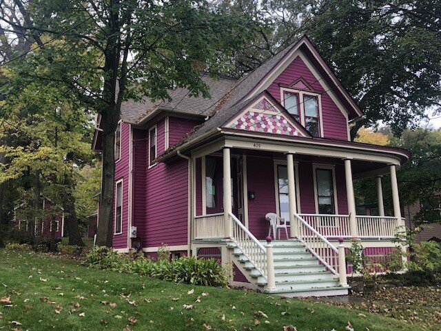
429 DIVISION STREET


HISTORIC SIGNIFICANCE
On July 7, 1880, Estisa and Patten Bartlett sold lot 10 of the E. M. Bartlett addition in Elgin to Francis Preston for $500. At that time, Francis resided at 271 (now numbered 421) Division, adjacent to this lot. He quickly improved the lot by building the home that is known as 429 Division Street.
Francis apparently used the new house at 429 Division Street as a rental property, never living there himself. The 1884 City directory lists tenant Charles Young at that address. Francis retained ownership of 429 Division until selling it in 1889 to Conrad and Lydia Buel for $3,500.
Francis was born in New Hampshire in November of 1832 to Paschal and Ruth Preston. Frank enlisted at the beginning of the civil war in his home state of New Hampshire and served as a commander throughout the war.
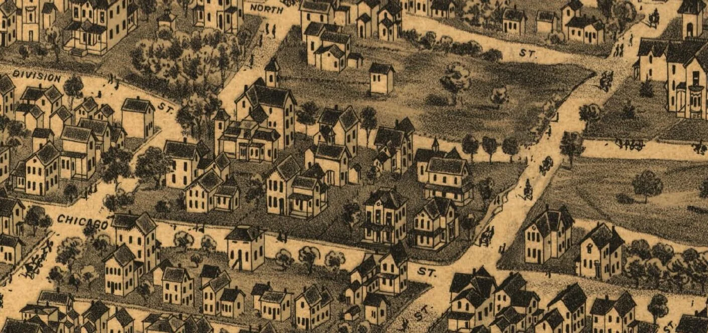
After he settled in Elgin in 1868, he was very active in the GAR, The Grand Army of the Republic. Francis was employed at Elgin National Watch Factory and was known to be a fine musician. For many years he was the leader of the Bluff City Band and a prominent member of the Elgin Watch Factory Band. Near the end of his life, he was elected town collector, but was unable to attend to his duties because of his health. The 1878-79 Elgin city directory lists Frank Preston as the assistant foreman of the screw and steel department of the Watch Factory and also the business manager of the Bluff City Band. His address was listed as “Division 2 east of Gifford” as there was no house numbering system in use at that time.
Francis’ first wife, Fannie M. Dockum Preston, was born in 1832, and died on September 20, 1885. She is buried at Bluff City Cemetery. They had two children, Eudell, born in 1856, and Frank, born in 1860. Frank died in 1876 and is buried at Bluff City Cemetery. In 1887, Francis married his second wife, Ella Shields. Francis died in 1904 at the National Soldiers Home in Milwaukee after a long illness of paralysis.
ARCHITECTURAL SIGNIFICANCE
429 Division Street was built as a substantial Free-Classic Queen Anne style home. The recent historic resources survey lists the home as a contributing structure to the historic significance of the area and in excellent condition.
The development of balloon framing, a construction methodology using smaller dimensions of lumber than previously, permitted the evolution of the exuberant Victorian architecture with its asymmetrical facades and irregularly shaped roofs. Previously, post-and-girt and braced-frame construction both used hewn and/or pegged joints and massive timbers. Since corners were thus hard to stabilize, architects and builders avoided unnecessary corners. Balloon framing construction, developed in Chicago in the 1830s, used two-inch framing boards that extended through two full stories. The joints were nailed, making construction faster and less costly. To the delight of Victorian architects, the small lumber dimensions allowed easy construction of irregular plans with many bays, extensions, turrets and towers. Queen Anne Style was developed in England by architect Richard Norman Shaw and associates. The style, popularized in plan books and magazines, became the predominant architecture in the United States, accounting for 50% of all homes constructed from 1880-1910.
Typical of Queen Anne Style, this house is a cross-gable configuration with a prominent front-facing gable. Like 50% of these homes, it has a steep hipped roof with lower cross-gables placed asymmetrically on the facades. The main roof has a flat deck crowning the hip, where the chimney is located. The Free Classic sub-type accounts for 35% of Queen Anne homes. The name derives from the use of round classical columns rather than turned posts as porch supports. Here, the columns extend the full height of the porch. The polygonal dining room bay features inset rectangular panels under the windows, and decorative brackets supporting the roof of the bay. Decorative woodwork graces the gable over the entry. A triangular window hood is present over the double window on the front-facing gable.
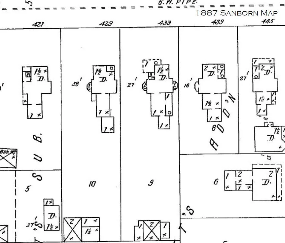
Shown in the 1897-1913 Sanborn Fire Insurance maps was a two-story accessory structure located at the southwest corner of the lot, with two one-story sections on the east side. This was destroyed by fire. The 1939 Sanborn map shows the present garage, built in 1936, at the southeast corner of the lot.
TIMELINE OF PREVIOUS OWNERS
Sources: 2019 Heritage Plaque Application; Audio: TextAloud